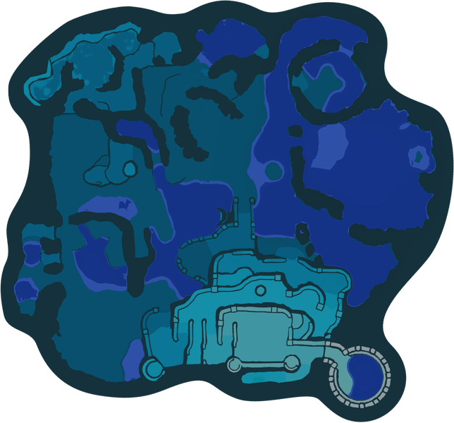
File:Serene Shores high tide map.png
Jump to navigation
Jump to search

Size of this preview: 644 × 599 pixels.
Original file (1,524 × 1,418 pixels, file size: 481 KB, MIME type: image/png)
Summary[edit]
| File information | |
|---|---|
| Summary | Radar map of the Serene Shores as it appears before noon, rotated to be north-up and with bodies of water composited in. |
| Type | Map |
| Game | Pikmin 4 |
| License | This file is subject to copyright. Copyright is most likely held by the company that published the game or media portrayed in the image. Pikipedia's use of this work qualifies as fair use under United States copyright law, or the author's permission is given. It is used on the wiki only in the belief that the information the image portrays is designed to be an accompaniment to playing the game or media, and its use here will not:
|
File history
Click on a date/time to view the file as it appeared at that time.
| Date/Time | Thumbnail | Dimensions | User | Comment | |
|---|---|---|---|---|---|
| current | 21:19, March 1, 2024 |  | 1,524 × 1,418 (481 KB) | Trig Jegman (talk | contribs) | zopfli |
| 12:39, February 10, 2024 |  | 1,524 × 1,418 (702 KB) | PopitTart (talk | contribs) | {{file info |summary = Radar map of Serene Shores as it appears before noon rotated to be north-up and bodies of water composited in. |type = screenshot }} |
You cannot overwrite this file.
File usage
The following 5 pages use this file: